S.E Asia Part 2: Malaysia
Sunday, 6 June 2010
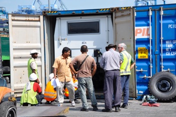
By 11.45am we were on the road. Surprisingly only 2 and half hours after arriving at the port and an hour of that was trying to find the company office and container amongst the acres of port activity.
Our container ship was delayed leaving Brisbane by 4 days and with its arrival only on Saturday, driving away today was remarkable. Very much different from the three weeks it took us in Port Vestochny in Russia when we arrived at that port in May 2007.
With yesterday to fill in we discovered a building of electronics and within a Garmin store. Bill purchased the Nuvi road map chip of Malaysia, Thailand and all China for MYR300 (A$107) and I purchased the entire North American continent for MYR220 (A$78) and already the Nuvi map of Malaysia is helpful.
Hot it is, very hot and extremely humid. Unloading was a sweat box; even driving, the air con had difficulty keeping up.
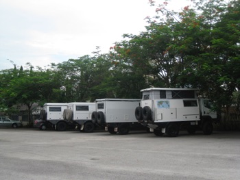
At 4.30 we have now stopped for the day, parked up in the parking area of the Selangor River fire fly tour area. The perspiration is still dripping from us and continues to do so right into the early night.
Fortunately after our river row boat trip viewing the fire flies the temperature started to drop making the evening at least somewhat pleasant.
Camp 1: Fire Flies River 70Kms North of Kuala Lumpur
N03*21.661 E110* 18.089
Distance Travelled: 95Kms
Wednesday 2nd June 2010
This morning we had time to organise the trucks and put things away although that process will continue for a few days until we settle in to a system.
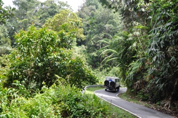
Leaving the coastal fringe we climbed the mountain range that forms the backbone of Malaysia. Not only was the scenery beautiful the temperature was increasingly more pleasant as we gained altitude. The road was a work out for the driver particularly the last 7kms single lane up to Frasers Hill.
Frasers Hill was a ‘Swiss’ mountain retreat dating back to the turn of the century when the English gentlemen and their ladies would holiday away from the oppressive heat.
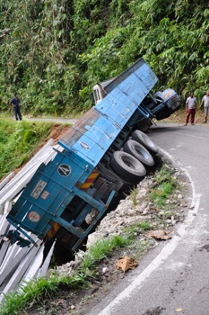
For some drivers the vehicle length made the ‘Z’ turns impossible.
That evening we called into the town of Jeramtut for dinner. They were just setting up the tables as we were approached by the owner of one of the outlets. Not knowing we asked which establishment he could recommend. Not only did he look after us extremely well, he and his son also run one of the many the long boat tours at the Taman Negara rainforest area where we are heading this evening.
The meal was great, we ordered six plated of different noodles and rice together with fresh fruit juice all around came to MYR 31 (A$12 /6 = about A$2 each person) We also managed to negotiate for his son to take us tomorrow on his boat tour for MYR120 for the group.
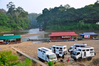
Camped by a river surrounded by pristine Jurassic rainforest congers up a vision, not exactly the one we woke up to on Thursday morning. This village has found the tourist trade beneficial to their life style. Floating restaurants and souvenir shops line the river as high powered long boats shuffle the tourists across the river to the main entrance to the park.
We are camper on the river bed in the midst of all the activity.
Camp 2: Taman Negara National Park
N04* 25.688 E103* 27.300
Distance Travelled Today: 325Kms
Total Distance: 425Kms
Thursday 3rd June 2010

Taman Negara is apparently one of the only continuous rainforests from the Jurassic period about 130 million years ago.
As we motored up the river, crossing the many rapids on the way, huge trees with varying shades of green through to orange lined the horizon on all sides. Significant stands of bamboo intermingled with vines and palms made up the dense green undergrowth.
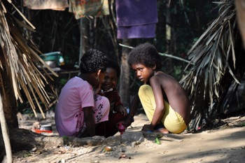
We visited a native village where they still live in palm frond huts and occasionally hunt birds and monkeys using blow darts.
These Malaysian native people are related to the New Guinea Fuzzy Wuzzies
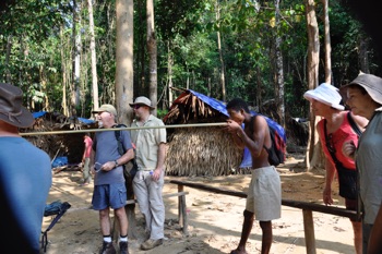
Our guide suggested and we did contribute MYR 5 per person to the head man for allowing us the visit, and showing us how they light fire without matches and also use the blow darts.
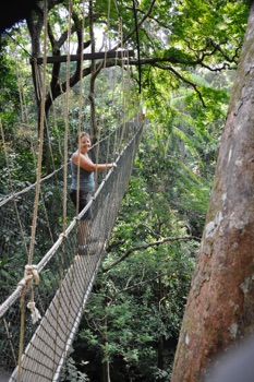
Our next adventure was the canopy walk. Five rope platforms slung between giant trees. This walk was over 280metres long – quite impressive, something Lyn had difficulty viewing considering her eyes were closed.
We had been told of a walk to the top on one of the mountains where you could see the wild rivers however after struggling up some 1.5kms of stepped track; the view was not as inspirational as expected. We tried a new way down but that only took us another 2kms out of our way. The end was an exhausting day of solid bushwalking for 12Kms, that was only compensated by late lunch at around 3pm of some good noodles and rice at one of those river side restaurants.
It was time for a swim in the river followed by a rewarding Tiger beer.
Camp 2: Taman Negara National Park
Distance Travelled Today: 0 Kms
Total Distance: 425Kms
Friday 4th June 2010

Passing on blind corners like this happens all the time.
‘Must have a different God!”
Following winding country roads through square kilometres of palm oil plantations we finally broke out of the mono-culture environment onto the costal valley. Rice paddies, fruit trees then city environments surround us. Following the coast north of Kuantan and keeping off the expressways we found a semi-secluded beach behind the town of Kemasik.
Many of the locals came and talked and one of them suggested we go to the night market about a kilometre away. Walking around that was an experience. Here we purchased dinner grilled chicken pieces, satays with peanut sauce and an exotic array of tropical fruit. We returned to camp to feast on the above followed by Rumbutan, Watermelon, Guava,
Banana, and our favourite Mangosteen.
Camp 4: On the Beach at Kemasik
N04* 25.688 E103* 27.300
Distance Travelled Today: 291Kms
Total Distance: 717Kms
Saturday 5th June 2010
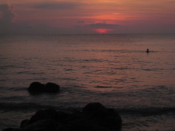
The South China Sea was still warm for our early morning swim.
We refuelled at MYR 1.70 per litre (A$0.94) and topped up the water tanks from the service station.

Following the coastal road north we stopped at Marang and caught the fast ferry across to Kapas Island. Our afternoon was spent lazing on the beach and snorkelling.
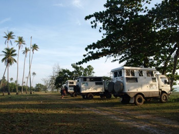
Our camp is again by the beach about 15Kms north of Kuala Terengganu. Having just finished another enjoyable meal at a roadside eatery for the grand sum of MYR 28 (A$15) for the six of us it was for an early night.
Camp 5: Under Leichardt Trees on the Beach at Kuala Terengganu.
N05* 25.841 E103* 04.174
Distance Travelled Today: 143Kms
Total Distance: 860Kms
Sunday 6th June 2010
We are awakened at 5.30 am each morning with the calling to Allah. Most times it is pleasant sound of the caller however this morning it must have been the apprentice because it he definitely needed more practice. As with most camps the morning noise also includes the roosters crowing and this morning, cows graze behind our trucks.

Tasting Dragon Fruit at a road side stall.
Last nights meal was another culinary experiment. We knew that Nasi Goring was fried rice but the extras were always a guessing game. So as usual we order 5 or 6 different dishes by just pointing to the word on the menu. Todate this had been great because we get to sample all the meals by just swapping the dishes around the table, the only down side is when we find a dish we really all enjoy, trying to find its name for next time proves problematical.

Driving north along the smallest costal roads we found some beautiful campsites that stretched for about 20kms out to a small peninsula. These are east of Setiu and the GPS coordinates are listed in the DIY section on Malaysia, as will be all the campsites we found together with border crossing details etc. This will be completed and posted on our return.
This area was so nice we stopped for a swim and coffee on the beach.

Lunch was a road side restaurant where again we caused confusion trying to order meals. In the end we enjoyed a vast variety. Lyn’s favourite was white noodles in coconut sauce, with shredded cabbage and chillies.

We reached the Malaysia/Thai border around 3pm and although somewhat confusing we were on our way by 4pm. The temperature was HOT, just as we started the vehicles I noticed the inside temperature was 43 degrees. Perspiration was running rivers.
The crossing process is fully described in the Overland to Thailand.
The southern side of Thailand has been experiencing some unrest and we must have crossed through more than 20 army check points, zigzagging through timber and razor wire with heavily armed Thai solders.
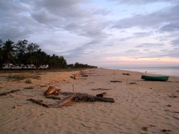
Following the small coastal road north of Narathiwat we wound in and out of villages. In one of them it was obviously the local recyclers / junk dealers. Bicycle tyres were piled 3 metres high, broken children’s toys 2 metres high, assorted piles of scrap steel, wire and everything imaginable. Around all this the inevitable plastic bags blew across the road, were stuck in trees, on fences and blew around the ground.
Our final camp was just near a small fishing village of Sai Buri.
Camp 6: Thailand. Under Coconut Trees on the Beach North of Narathiwat
N06* 41.559 E101* 39.123
Distance Travelled Today: 297Kms
Total Distance: 1158Kms
